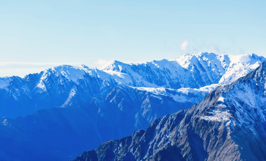
Modern civil infrastructure is pushing into the world’s most hostile environments. At altitudes above 15,000 feet, traditional engineering methods fail due to extreme weather, thin air, and highly volatile glacial terrain. To protect vital transport arteries and energy grids, a new technological discipline has emerged: High-Altitude Cryospheric Engineering (HACE). By combining spaceborne sub-surface radar, automated drone fleets, and controlled kinetic fracturing, engineers are moving from reactive disaster management to proactive environmental control.
The Evolution of Mountain Hazard Mitigation
For over a century, managing high-altitude ice and snow risks relied entirely on brute force and high-risk human exposure.
The Manual Era (1900s-1950s): Mountain guides and alpine troops physically scaled unstable slopes to manually place dynamite charges. Crew mortality rates were high, and operations were limited by active storms.
The Artillery Era (1960s-2000s): Transport departments deployed military-grade howitzers or recoilless rifles to shell avalanche starting zones from valley floors. While safer, it lacked pinpoint structural precision and left unexploded ordnance in fragile alpine ecosystems.
The HACE Paradigm: Today’s operations integrate real-time digital modeling with unmanned systems to surgically neutralize structural threats before they trigger catastrophic landslide dams or catastrophic flash floods.
The Two-Phase HACE Operational Framework
Modern cryospheric engineering requires a systematic transition from long-range orbital monitoring to high-precision physical deployment.
Phase 1: Digital Structural Cloning (The Long-Term Priming Window)
The core of modern high-altitude engineering lies in creating a long-term “Digital Twin” of the alpine environment. Engineers use a multi-layered orbital matrix to track stability long before deploying teams.
Repeat-Pass Radar Interferometry (InSAR): Civilian satellites monitor targeted glaciers at rigid 6-to-12-day intervals. By comparing phase shifts in overlapping radar waves, automated software maps micro-deformations down to millimeter-level precision, tracking active creep velocity months before a visible crack appears.
High-Frequency X-Band Backscatter Analysis: High-altitude ice is often masked by dense, deceptive winter snow bridges. Active X-band microwave arrays easily penetrate this superficial powder layer to map the complex interior geometry of hidden crevasses.
Grounding Line & Hydrostatic Tracking: Using differential radar paired with satellite laser altimeters, teams measure the subtle vertical swelling of glaciers. This data registers exactly when subglacial meltwater pools begin to accumulate under the ice, signaling when basal friction drops to a historic minimum.
Phase 2: Autonomous High-Altitude Drone Interventions
Once orbital data identifies a critical structural threshold, heavy-lift drone ecosystems are deployed to execute precise kinetic remediation.
Ultra-High Ceiling Unmanned Aerial Vehicles (UAVs): Standard commercial drones lose aerodynamic lift in thin air. Modern HACE operations deploy specialized heavy-lift platforms engineered with oversized carbon rotors and high-voltage propulsion systems capable of stable flight up to 23,000 feet / 7,000 meters.
Electronic Ignition and Precision Payload Dropping: Instead of indiscriminate bombing, drones utilize stabilized, GPS-guided delivery pods to deploy timed, specialized payloads directly into pre-mapped structural crevasses.
Spherical Overpressure Fracture: Rather than trying to melt or blast away millions of tons of ice with thermal heat, the payload generates a highly calculated, rapid acoustic or kinetic shockwave. By synchronizing this pulse with the glacier’s natural resonance frequency, engineers instantly shatter the mechanical cohesion of the ice boundary, triggering a safe, highly controlled release.
Operational Benchmarks: Primary HACE Case Studies
To understand how these individual technologies function in the field, we look at four foundational deployments that prove the viability of high-altitude structural manipulation.
The Infrastructure Monitor: Karakoram Highway Corridor (China/Pakistan)
The Technology: SBAS-InSAR Spaceborne Radar Time-Series Analysis.
The Application: To protect the highest paved international road in the world, engineers utilize satellite radar datasets to capture per-pixel surface displacements. This allows tracking of sub-surface deformation trends and ice creep along slope boundaries long before visible cracks appear, establishing that satellite radar can actively inventory structural blind spots without any ground-based footprint.
The Kinetic Blueprint: Jasper National Park PAMS Operation (Canada)
The Technology: Heavy Enterprise UAV Platforms & GPS-Guided Electronic Overpressure.
The Application: Avalanche technicians replaced traditional artillery shelling with autonomous drone flights. The aircraft fly directly into localized starting zones to deploy targeted, electronic-ignition explosive canisters into pre-mapped structural fractures. By generating precise spherical overpressure waves at the absolute weakest points of ice bridges, it establishes that minor, highly localized kinetic energy can unseat massive volumes of frozen material if the structural geometry is pre-calculated.
The Acoustic Trigger: Thwaites Glacier “TIME” Project (Antarctica)
The Technology: Suspended Air-Burst Explosives & Deep Seismic Reflection Monitoring.
The Application: Glaciologists used ammonium nitrate-based explosives suspended precisely 1.8 meters in the air via metal poles to execute controlled above-ground blasts. Seismometers captured the acoustic overpressure reflection to map subglacial terrain features through miles of dense ice sheets. This validates the specific use of air-burst overpressure technology, proving that above-ice detonations send perfect acoustic shockwaves into a glacier’s core bedrock interface to alter or map its mechanical cohesion.
The Aero-Acoustic Limit: Chongce Ice Cap Operations (Tibetan Plateau)
The Technology: High-Ceiling VTOL Drone Platforms.
The Application: Glaciologists successfully mapped high-altitude glaciers on the Tibetan Plateau at heights exceeding 19,500 feet / 6,000 meters using specialized vertical take-off and landing (VTOL) drones. This real-world test completely dispels any skepticism about drones operating at extreme heights, establishing that unmanned flight aerodynamics and automated navigation are fully functional and precise in ultra-thin, low-oxygen atmospheres.
Comprehensive Case Ledger and Technical Precedents
- Karakoram Highway Corridor (China/Pakistan): To protect the highest paved international road in the world, civil engineers utilized SBAS-InSAR Spaceborne Radar Time-Series Analysis. By analyzing satellite radar datasets to capture per-pixel surface displacements, teams actively tracked sub-surface deformation trends and ice creep along slope boundaries. This deployment established that satellite radar can successfully inventory high-altitude structural blind spots and predict early slope instability without requiring any physical ground-based footprint.
- Jasper National Park PAMS Operation (Canada): Avalanche technicians in Canada’s rugged national parks replaced traditional military artillery shelling with autonomous, heavy Enterprise UAV flights. The aircraft navigate directly into hazardous starting zones to deploy targeted, electronic-ignition explosive canisters into pre-mapped structural fractures. By generating precise spherical overpressure waves at the weakest points of ice and snowpack bridges, this operation proved that minor, highly localized kinetic energy can safely unseat massive volumes of frozen material if the underlying structural geometry is pre-calculated.
- Thwaites Glacier “TIME” Project (Antarctica): Glaciologists investigating the West Antarctic Ice Sheet deployed suspended air-burst kinetics to map deep basal interfaces. By detonating ammonium nitrate-based explosives suspended exactly 1.8 meters in the air via metal poles, they generated precise above-ice acoustic shockwaves. Seismometers captured the overpressure reflections to map subglacial terrain features through miles of dense ice, validating that above-surface detonations can alter, measure, or map mechanical cohesion at a glacier’s core bedrock boundary.
- Chongce Ice Cap Operations (Tibetan Plateau): To overcome the extreme aerodynamic limitations of thin mountain air, glaciologists deployed specialized high-ceiling vertical take-off and landing (VTOL) drone platforms. Operating at hyper-altitudes exceeding 19,500 feet (6,000 meters), these unmanned systems successfully completed automated navigation paths and terrain photogrammetry. This field deployment completely dispelled skepticism regarding UAV functionality in low-oxygen environments, proving that automated flight controls remain precise at extreme alpine limits.
- Otemma Glacier Campaign (Switzerland): The University of Lausanne revolutionized rapid subsurface mapping by deploying automated, autonomous UAV-GPR systems across the active Otemma Glacier valley. The drone fleet captured an astonishing 112 line-kilometers of high-resolution subsurface structural data in just 96 hours. This campaign established that an entire glacial ecosystem’s internal hydrological pathways can be completely cloned in days, proving that macro-scale structural telemetry can be acquired during tight operational weather windows.
- Tête Rousse Glacier (French Alps): Faced with a critical flooding hazard, engineers in France executed a high-precision subglacial draining operation using borehole radar mapping and targeted explosive blasting. Teams used the radar data to tunnel directly into a hidden, highly pressurized 65,000-cubic-meter subglacial water pocket beneath the ice sheet. By intentionally breaching this internal reservoir, they successfully relieved the immense hydrostatic pressure from within, proving that targeting a glacier’s internal water chambers can immediately trigger structural and physical releases.
- Kitzsteinhorn Glacier (Austrian Alps): Safety crews in the Austrian Alps advanced automated risk diagnostics by mounting Ground Penetrating Radar systems onto industrial drones. The UAVs scanned high-altitude snow and ice packs while onboard boundary layer detection algorithms instantly calculated stratigraphy risks. This real-world implementation demonstrated that automated software can scan internal ice layers to diagnose active sliding and internal friction degradation without exposing ground crews to hazardous mountain terrain.
- Jakobshavn Glacier Proposal (Greenland): In a bold turn toward macro-scale environmental engineering, climate scientists advanced geoengineering proposals to install massive 100-meter-tall gravel and concrete seabed embankment barriers in Greenland. The physical intervention is designed to block warm Atlantic marine currents from melting the fastest-moving glacier’s basal grounding lines. This initiative illustrates that modern engineering is actively transitioning toward modifying the physical boundaries where ice meets rock to directly dictate global ice stability.
Summary
High-Altitude Cryospheric Engineering (HACE) represents a fundamental paradigm shift in how humanity navigates volatile montane environments. By synthesizing satellite interferometry, penetrating radar, high-ceiling aviation, and frequency-matched kinetic triggers, modern asset management is shattering traditional geographic constraints. Empirical data validated across global field sites proves that frozen formations are no longer unmappable black boxes or uncontrollable hazards; rather, structural anomalies can be diagnosed long before a catastrophic failure occurs. Glaciers and alpine slopes are now understood as dynamic mechanical systems that can be digitally modeled to the millimeter and safely stabilized from afar. As these remote monitoring matrices and autonomous intervention tools mature, the ability to read, predict, and systematically modify the structural integrity of alpine topography will define the vanguard of civil engineering, geomorphological protection, and high-altitude resource management.
About The Author